
About the Division
The Division of Land Registration & Survey is mandated by Public Law 3-79 to Survey Ore-War Properties, Record Documentation & Map, Review & Clearance of all Submitted Check Prints, Provide research area with professional services for the General Public on a daily basis.
Our Mission
The mission of the Division of Land Registration and Survey is to conduct survey of pre-war properties, issued title determination and record certificate of title and all document previously registered with the Commonwealth Recorders, hold hearings on disputed land claims, research all pending land claims filed to verify the validity of the claims, provide survey assistance to the public land and various government agencies, review and approve private and government survey maps, manage and administer CNMI land records.
Our Vision
The Division visualize the organization of Land Data & Mapping for faster references in the upcoming years with Research Area & Focus on upgrading more into the DATA System (Geographical Information System) to expand the filing system in a more convenient and safer place.
Our Goals
The Division of Land Registration and Survey shall proceed on a systematic geographical basis in; promptly accomplish the registration of all and with the Commonwealth giving priority to the surveying pre-war properties to which the Trust Territory government issued title determination of ownership without actual surveys; resolve pending land claims; accomplish scanning and digitizing of all original land records and maps and continue to maintain and upgrading of the CNMI land parcels.
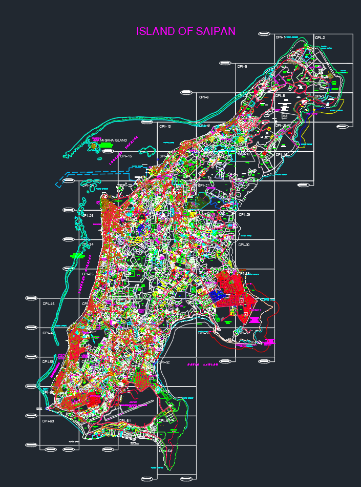
Download your maps here!
Explore and download the maps of Saipan, Tinian, and Rota from our Land Registration and Survey team, generated using AutoDesk's CAD Software
- Saipan Map (DWG File, 245.8 MB)
- Tinian Map (DWG File, 54.6 MB)
- Rota Map (DWG File, 20.4 MB)
* CAD Viewer required to open and view DWG map files.
DLRS Sections
The Division of Land Registration & Survey is subdivided by four sections:
-
Administration: Administration Section has the responsibility of ensuring that the administrative activities within an organization run efficiently, by providing structure to other employees throughout the division. These activities can range from being responsible for the management of human resource, budgets and records, to undertaking the role of supervising other employees. Computer Specialist is updating and inputting land data documents and survey approved maps for DLRS Records Section.
-
Research: Land Information Section holds land documents and maps, organizing and updating land information data, records and files all incoming land document, server to store all record data and formatted to furnish the Public a convenient records reproduction services and an area for self-research.
-
Survey: Surveying Section prioritizing the surveying of pre-war properties that begun in 1969 during the inception of the Land Commission and as the priority of the divisions Pursuant to Public Law 3-79.
-
Land Registration & Adjudication: Land Registration & Adjudication Section proceeds to accomplish the registration & title of all Pre War lands in the Commonwealth & resolving all new and late land claims Pursuant to Public Law 3-79.